 At 19.5 miles, along SH 95, I suddenly spotted a sign that said "Mule Canyon/Texas Flat Road"; never saw this sign before in our travels along 95, and a half mile further on was the actual roadside ruin. We parked, stared at each other for a bit; sly smiles came to all our faces; making a U-turn, back to that other road we went. After going over the cattle guard, there was a pull-in area a little ways down with a BLM Information board; map, rules, guides about hiking, camping, ATVing and 4 wheel driving. Oh, word of warning, you better have a 4 wheel drive vehicle as the road keeps changing from rocky to rutted; we'd had snow recently and the mud puddles were deep.
 At one mile, we came upon a wooden bridge spanning a stream; to the left was a hiking trail (info. board at the trailhead); to the right was a slickrock area and a good view of the stream.
To the Left.


To the Right


At 3 miles, we came upon a beautiful area obviously used for camping, but also great for a picnic. Roy and I actually came back the next day, with our dog Jenna; ate a picnic lunch while she checked out the area.
 |
| 3 Miles along road. |
 |
| View from the area. |

But at the top of this climb, simply an additional half mile from the camping/picnic stop was an exquisite overlook of Mule Canyon.
Mule Canyon Overlook


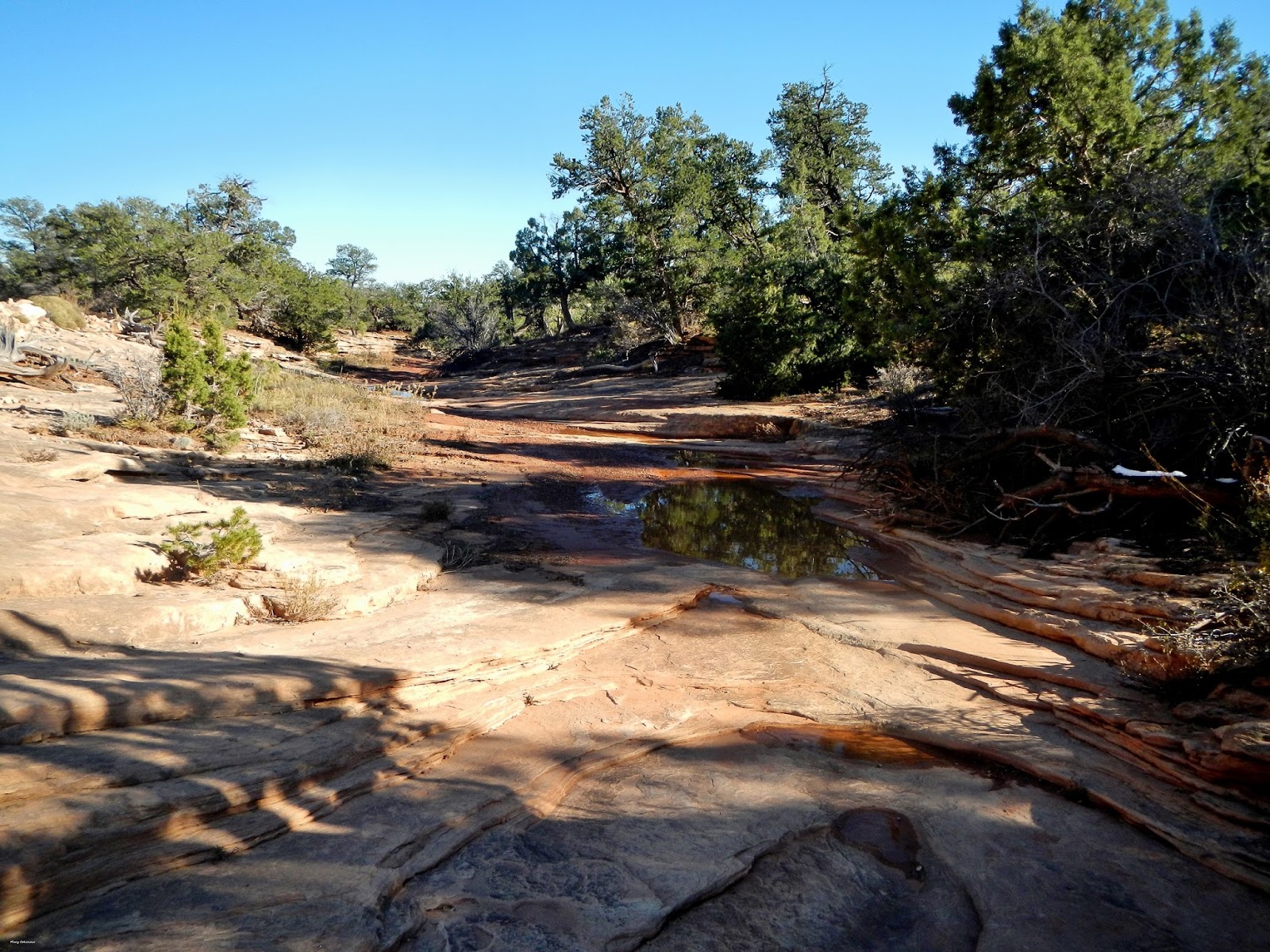
At 5.5 miles we crossed through a slickrock dry wash which contained evidence of the recent snow in the form of puddles. It's areas like this that tourists often get surprised by flash flooding; they didn't bother to read up on the area, nor read the information boards.

At the 6 mile mark, a trail goes off to the right; this leads to an overlook of Arch Canyon. Unfortunately, the trail was so badly eroded, due to the weather, that driving it was impossible. Otherwise, the trail can be driven to a parking area, and then a short hike to the overlook itself. I used my zoom lens to get a photo, but I bet the overlook area itself would be more outstanding. Yes, it is on our to-do list for 2016.


 Our journey ended at mile mark 6.6 where the road has no longer been maintained; it is now accessible by ATV or hiking only. Texas Flat is beyond, and definitely beyond our reach.
The ride back to SH 95 was just as rocky and rolling as the ride in; poor Amy was in the backseat getting bruised with each deep rut hit.
However, we had a great time and look forward to the next adventure; whatever it is, or wherever it takes us.
Mary Cokenour
No comments:
Post a Comment