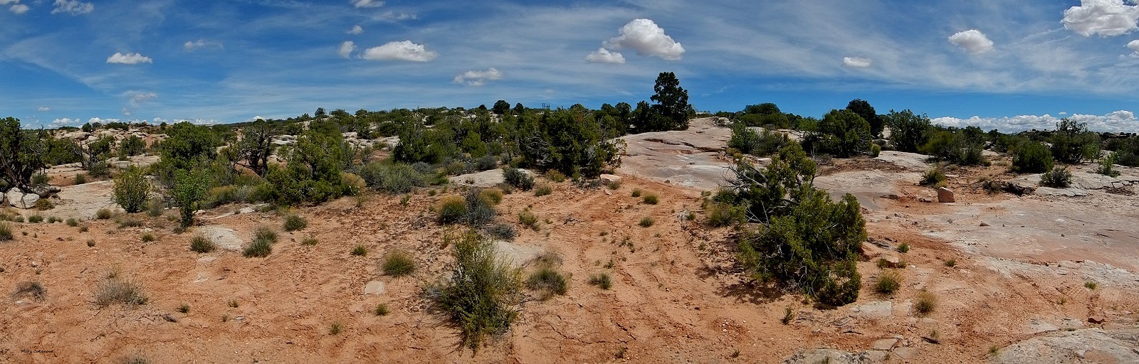
Butler Wash Ruin is a cliff dwelling
that was built and occupied by the Ancestral Puebloans, sometimes known as
Anasazi, in about 1200 AD.There are
habitation, storage and ceremonial structures, including four kivas.
·Location
is 35.0 miles from Monticello; take Hwy. 191 south into and through Blanding,
24.6 miles, until the junction of State Hwy. 95, make a right onto Hwy. 95 and
travel 10.4. There will be a sign
indicating the turn off into the parking area.
·Round
trip hiking distance is 1 mile and takes approximately 30-60 minutes.
·Difficulty:
Moderate. Trail to the site winds its
way across slickrock and into/out of washes to reach an overlook of the cliff
dwelling. An interpretive
sign is located at the overlook.
·Vault
toilets, parking area; but no drinking water available.
·Admission:
Free
·Camping:
Not Allowed
·Pets:
Allowed, owners are expected to clean up after pet (s).
There are a couple of benches along the trail; sit and enjoy the scenery. Bring a picnic lunch, but whatever you pack in, must be packed out!
So there we were, back at the 1 mile junction (from Route 191), trying to figure out which was the 4 wheel drive trail while the mountain biking trails were quite obvious. Scanning the landscape, we noticed two pickup trucks parked in the distance and simply followed the trail they were on back to us; now we knew how to head on.
While a passenger car could make it to the dinosaur tracks area (see Part Two), this trail was a definite 4 wheel drive must; having a skid plate helped a lot too, and hope you don't mind tipping to either side here and there. I'm not huge on tipping vehicles, so I did end up walking a quarter of a mile sometimes, but hey, it's good exercise!
At mile mark 1.4, there is a junction for three separate mountain biking trails; at 1.6 miles, the Dinosaur Stomping Trail begins which can be hiked or mountain biked. As much as we wanted to see the other dino tracks, we were not fully prepared; not enough water for a major hike plus continuing our exploring of the trail we were currently on. Have to play it smart to stay safe and healthy out here in the desert; it's not a Disneyland park, and it's most definitely NOT idiot proofed.
Driving on, the landscape stays pretty much prehistoric; mile mark 2.3 are bike trails for Baby Steps and Jasper/Agate; 3.3 miles is the Little Salty Trailhead. Yes mountain bikers, you may all thank me now for giving you this information; investing in maps is still a good idea though.
At about 5 miles the Klondike Bluffs offer up a peak at them; 5.4 miles is a junction and here is where it might get a bit confusing. So, the sign for Klondike Bluffs points to the left, but there is a sandy trail to the right with no information. Checking our maps (yes, we carry more than one type always), the trail to the left is the Jeep Safari trail. Ok, how bad can that be, right? Wrong!!! We had only traveled 3/10s of a mile and came to...hmmm, how to describe this....a rather large step to reach the next section of trail. To the side of it, hikers or bikers could get easily through, as a couple of mountain bikers soon showed us as they whizzed by (showoffs!!!) Yeah, no, we weren't doing this on our own; at least with Jeep Safari, there is a group of Jeeps and people to help each other out.
Klondike Bluffs Jeep Safari Trail
Cross over a dry wash.
The "Oh Hell NO!!!" moment - it's steeper than it looks in the photo.
We went back to the junction and sat for a few minutes deciding if we should return back the way we came, or try out the sandy trail that was now in front of us. The unknown won, and would you believe, in just one mile we reached the staging area on Klondike Bluffs Road (see Part One).
So Close, Yet So Far.
Since we had just traveled this road, we knew that turning left onto it would bring us to the "Blue" movie set; just one mile. The "Fallen Peace Officers Trail" is located there, so decided to check it out, and have lunch too. We had only gone one mile which included ascending slickrock before we came to a very rocky section and decided this was best left to ATV riders, not us. In fact, a senior couple drove by us while we were there, and then back again; they seemed to be having a good time. However, it was a glorious picnic site with stupendous scenery; that's why I always tell folks, "Bring a picnic!".
6/10s of a mile later, we came upon another section of "Fallen Peace Officers Trail" and tried it out; a little rocking and rolling until a sign (3 miles later) that stated we had reached the boundary of Arches National Park; no motorized vehicles allowed. Now who came riding towards us, that senior couple and they were as confused as we were. How can you have a 4WD/ATV trail that crosses through a National Park, but you're not allowed to ride it??? We know this trail also has a start off Route 191, but the maps have it looping around several times, including through the Arches, so....yeah, confusing. Oh well, back to Klondike Bluffs Road....
About 2.5 miles onward we noticed another sandy trail marked with cinder blocks; seeing the Bluffs, and Tower Arch, across the desert, well hell yeah we were trying this out! There were several camping areas along the way, and the trail finally did end at a dry wash, but we were able to get some nice shots of the Bluffs and Tower Arch (thanks to the zoom lens on my camera).
Tower Arch
Tower Arch
We went up and down a few other trails, but nothing brought us any closer to the Bluffs. It was starting to get late, we were very exhausted and headed towards Dalton Wells; we did get another view of the Marching Men though. We got home to Monticello in time to say, "The hell with it, lets go eat out at Shake Shack!"
Future plans are to come back, and check out more trails we saw, but just were too tired to explore this day.
After the snow had melted in the lower elevations of the Abajo Mountains, and the dirt trials were drier, it was time to go adventuring in the Manti-LaSal Forest. The initial destination was the road going past the Devil's Canyon National Forest Campground. For those who don't know where that is; from the southern end of Monticello (the Hwy 191/Hideout Golf Course split), it is 11.5 miles to the entrance to San Juan County Road 198/Forest Road 085.
The pavement ends at 6/10s of a mile; at 1.2 miles there is a cattleguard and you officially enter the Manti-LaSal Forest. There are ATV trails marked along this dirt (4 wheel drive recommended) road; primitive camping areas are designated by a stone fire ring. At 2.7 miles we stopped at a wide open area; that's when we got our first sighting of the rare, and elusive, Abert's Squirrel.
ATV Trails are marked.
We're constantly being asked about this squirrel, no, not details about the creature itself, but where to exactly find, and see, it. News Flash: this is a wild animal, it is wherever it wants to be; there is no sign saying, "Look here!" It doesn't sit on the side of the trails waiting for you to stop, sign autographs, or take photo ops. In seven years we had not seen one of them, and on this little jaunt, we saw three in one hour...go figure.
The Abert's Squirrel aka Tassel-Eared Squirrel has tufted ears and white on the underside of a broad tail; new ear tufts are grown in October. It loves to munch on Ponderosa Pine and Mexican Pinyon seeds and cones; it can be mistaken for a rabbit when sitting upright; it can leap broad distances, making it appear to "fly". If you want to learn more about this little creature, the National Forest Service has a fact sheet here: https://www.nps.gov/band/learn/nature/aberts-squirrel.htm
We did pass over a canyon area with a creek running through it; it was very quiet, except for the bubbling of the water over rocks and fallen logs.
Here's a video of the creek.
At 6 miles there is the junction of three trails: Wagonwheel, Camp Jackson/Shay Ridge Trail System, SJC 110/FR084. This was back in May, so we had been told that snow still covered sections of the first two trails in more shaded areas, or at switchbacks; so we took the lesser of the evils...SJC110/FR084. There are also primitive camping spots at this junction, as well as restrooms.
Primitive Camping
SJC 110/FR 084
Resetting the odometer to zero, we were
immediately hit with fantastic views of the South Peak and rock ledges at 3/10s of a mile; 5/10ths brought us to a pond.
At 7/10s of a mile, we got a real surprise...Harry Hopkins Grave. So, who was Harry Hopkins, how did he die, and why is he buried off this forest trail? Here is what I found out about the man, and his short history in San Juan County.
Harry Hopkins Grave
GPS: 37.7830009,-109.436798
Birth: Unknown
Death: 1887
San Juan County
Utah, USA
Lacy (or LC Ranch) Cattle Company - this was another cattle company, along with the Carlisle Cattle Company, which was ranching cattle from Colorado and Texas. Of course, they were eventually driven out by the Mormon settlers, who gladly took over the land, and the ranch; the cattle herds went with the Cattle Company men to other locations.
"History of San Juan County" by Albert R. Lyman
1887 - Page 62
"In the late spring or early summer, while the new settlers were farming at
South Montezuma, and making such preparations as they could to move to
Monticello the next spring, the Ute known as Wash came in reporting a dead
white man somewhere up the creek. Parley Butt went with him and found the
body of a man named Hopkins. He had been cooking for the L. C. outfit and
someone had apparently shot him from ambush while he waited on a log
fence for the outfit to return. He had crawled a short distance from the fence
before he died."
1887 - Page 63
"A lone track was found not far from the place, and it may have been the Utes
who did the killing, though they protested strongly against the charge. The
blame, however, seems to be laid on the Navajos, with whom Hopkins had
been in an unpleasant mixup sometime before.
The body was too badly decomposed to be moved, and was rolled into a hole
made nearby for the purpose. At the head of Devil Canyon near the wagon
road, a stone may be seen in the scrubby oak brush. That marks the place
where the unfortunate cowboy found rest.
Though the Utes are generally exonerated from the blame of this killing, they
are reported to have been more or less hostile during that summer, and a
company of soldiers came in answer to someones call and camped at a
certain spring west of Monticello. The place is still known as Soldier Spring."
Now as much as the Mormon settlers blamed this and that on the Native Americans, they certainly didn't get along well with the cowboys of either the Carlisle or L-C ranches. Here's a quote from "Utah History to Go" (http://historytogo.utah.gov/places/monticello.html) that makes me wonder who really murdered poor Harry Hopkins; the Natives, or the Mormons?
"By the first part of July 1887 the men had their tasks well under way and had joined in a conflict with the cowboys of the Carlisle outfit that would continue for approximately the next eight years. Warning shots, heated disputes, and legal wrangling were all part of this tension as each group tried to control access to the area's water. Homesites established at Verdure, on the South Fork of Montezuma Creek, were not free of conflict either, with cowboys as well as Ute Indians adding to the stress."
Since all the people from that era are long dead and buried, and history is usually written by the victors, we'll probably not find out the true story, unless someone finds a written confession from dear old great grandpa. By the way, there is an information sheet, behind plastic, on the board marking Harry's grave, but it is extremely faded; a shame no one sees fit to keep it legible.
Nearby camping area.
Hiking/Horseback Riding Trail.
At the one mile mark we found some fencing; that's only 3/10s of a mile from Harry's grave, so could this have been the fence he was sitting on when he was shot???
Could he have crawled from this fencing to the place where his body lay???
1.9 miles we walked out to get a better view of the peaks, one being Abajo Peak, the highest in these mountains. We heard people talking, machinery working; down below were buildings of the Blue Mountain Dude Ranch.
South Peak
Abajo Peak
At 2.8 miles we came upon the road to the Ranch area; there are private homes along the road, so stay on the main trail. We met a lovely couple, from Blanding, who were caretakers; they told us the LDS Church ran the entire recreational facility. There are cabins, pavilions, barbecue areas, creek; anyone can rent out for family trips or events. There is a closed off section reserved for Monticello LDS only. I had to laugh for one of my coworkers went here for an event once and told me, "It's a secret place and I can't tell you where it is at all. Anyone who is not LDS can't know about this place." Surprise! We found it, and it's not that secret, simply fenced off, well the Monticello section only, from the rest of the facility. So much for a stealth mission through the forest.
At 3.6 miles we officially left the Manti-LaSal Forest; 5 mile mark and there we were back on Highway 191; turning north, we headed on home to Monticello which was only 8.5 miles away.
Oh, how could I leave this post without giving you a little peek at some plant life???
Long Leaved Phlox (Phlox family)
Yellow Salsify (Aster family)
This was a most enjoyable, informative and pleasure filled drive through the forest; you really should try it sometime.