Showing posts with label Moss Back Butte. Show all posts

Thursday, March 17, 2016

Fry Canyon, Around Tables of the Sun - Part Two.

Part Two is going to be rather short, blame the weather for that.  Anyway, this journey begins at mile mark 7.6 on Radium King Road (SJC 258) and the junction of SJC 2431 aka Moss Back Road.  The trails leading around Tables of the Sun, Moss Back Butte and exiting on SH95 are basically easy to difficult; extremely difficult when there is melting snow and red clay mud gushing up under the tires!!!  That is why there will not be a load of photos; we couldn't stop and take very many, or run the risk of getting deeply stuck.  Let me tell you, you haven't experienced truly gushy red clay mud until you are driving a vehicle....sideways!!!


The first mile is graded dirt, then it turns into natural terrain, very little grading, and lots of rocks.  At one section there is a steep incline, then decline which I walked; pointing out holes in the road, or moving large rocks.  Hint: 4 wheel drive, high clearance and skid plate are a huge, huge help.  Driving along, we were anywhere from a few feet to twenty feet away from the cliffs; on one curve I took photos of North Fork Red Canyon.  In the far distance we could see Monument Valley!!!  This canyon area is spectacular, definitely out of prehistoric times and we wouldn't have been surprised to see dinosaurs wandering down below.  Mile markings?  Oh, once I had to begin walking the road as a guide, mile markings went out the window.

North Fork Red Canyon


Traveling past the Tables of the Sun is great, so many sides trails leading to ???  The landscape is primarily desert and sage brush; and the trail was very dry.  It was as we began entering the more forest like area of the trail that we began noticing snow in spots.  Then we encountered more shaded area where the snow went across the road and for several feet onward.  Sliding now and then is when we noticed the thick clay mud underneath, not good.  We had just rounded the last of the three Tables when our vehicle decided going sideways would be more fun....not!!!  Finally straightening out, we did an eight point turn and headed back to where we came from.

Oh, we're going to try this out again....in summer....when it's hot and the entire road is dry....not in July when it's monsoon season.

So here's a photo of the Tables of the Sun, taken from Radium King Road....very dry Radium King Road.  I've also included a copy of a Tables of the Sun map done by SPEAR; you can access this map, and others at: http://www.spear4all.com/

Tables of the Sun


Part Three will take a while to get together; about 280 photos to go through; plus researching the history of the mining era in Fry Canyon.  Until then...

Mary Cokenour


Tuesday, March 15, 2016

Fry Canyon, The First Seven Miles.

Late February, Roy and I spent two days out in Fry Canyon, traveling up and down San Juan County Road 258 aka Radium King Road; exploring mines, petrified wood sites, photographing the formations and landscapes.  We even braved San Juan County Road 2431 aka Moss Back Road; driving under the watchful eyes of the three "Tables of the Sun".  It was exhausting, exhilarating, scary at times, and wondrous at others.  379 photos later, I now have enough material for a three part series on Fry Canyon; this is part one, the first seven miles along Radium King Road to the junction of SJC 2431.


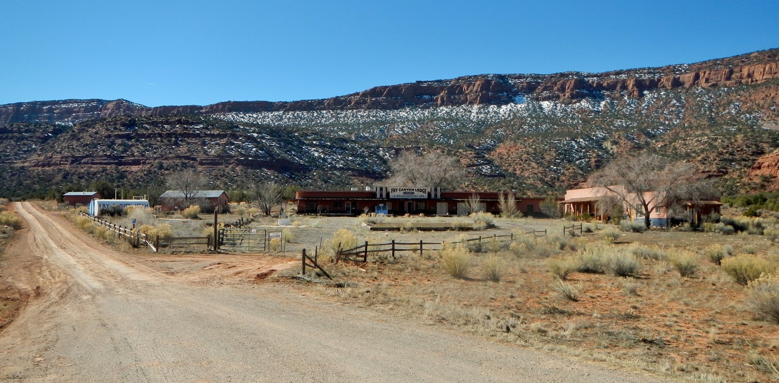
Our starting point is at the junction of State Highway 95 and SJC 258; Fry Canyon Lodge is privately owned and not open to the public.  Makes certain, before leaving Blanding, to have a full tank of gas, water and food; there is nothing available between Blanding and Hanksville. 


Even though you can see it from the highway, Fry Point is finally reached at 1.2 miles; to us, it resembles a railway engine; sort of like the one in the opening credits for the PBS "Poirot Mysteries" series.  Then again, it could be a battleship sailing full steam ahead!


"The Needle" is a desert tower at 3 miles; looking at it from up above, there is a dirt road circling around it.  Hundreds of years from now, will someone look at it and say, "What mystical place was this?"  There is a dirt trail leading out to it, but only about halfway; hiking will get you there the rest of the way.


At 4.9 miles, the road begins its trek upwards; it is graded all the way through, but being a dirt road, don't expect perfect smoothness.  At certain curves, it will have a switchback to allow other vehicles to pass by; the views are stunning the higher upwards you drive.


Center, far distance, Jacob's Chair.

While Roy was checking out a dry wash, I decided to stretch the legs by walking up the road.  I could feel the air becoming thinner as I ascended, but I'm pretty acclimated to it now, so didn't bother me much.  Now what took my breath away were the views!
Yes, the road winds around the hills.


Moss Back Butte


Just as you come up around a corner at 6 miles, you come to an amazing sight...a set of fins, a little arch, and a huge boulder flanking both sides of the road.


Cracked Fin


Looking upwards at the nearby landscape.

Just past this dynamic trio was a rock formation that looks like a snapping turtle, with a shark fin nearby.

Not every formation in Utah has a name; but having a good imagination allows you to name it yourself.


Almost done with this post as we near mile mark 7; a grotto of multi-colored adobe and sandstone hills.  Melting snow was flowing down and created a small stream; a drainage pipe allowed it to flow underneath the road and cascade out into a small canyon on the opposite side.


View from the seven mile point.

 Water drains down into this small canyon like area.


...and this ends part one, the first seven miles.  With this photo, around the next corner, begins part two.

Mary Cokenour

Thursday, January 28, 2016

A Winter Gallivant Along State Highway 95.

Between Dec 23, 2015, and the first week of January, 2016; San Juan County was slammed with winter storms; where I live, in Monticello, got about 4 feet.  No area was spared, not even Monument Valley which is usually much warmer than the rest of the county.  So it was no surprise that, as soon as main roadways were finally cleared and clean, Roy and I would get out of the house to go joyriding.  First we stopped in at Patio Drive-In to pick up lunch which we happily munched driving along State Highway 95.


As we turned onto the highway, we became surrounded by cloud cover; we could see easily down the pavement, but the landscape was not as discernible.  Snow and frost covered trees, bushes and tall grasses; we were traveling through a mysterious, arctic wonderland.


Between Mile Mark 116 and 117.
Traveling Westward.


Snow streaked Comb Ridge loomed starkly against the grayish-white sky; as we drove through the pass, we noticed more current rock fall.


Looking Back Eastward.
Entrance to Lower Arch Canyon.


The various canyons along the way were heavily laden with snow; icicles hanging from tree branches.


It wasn't until we'd passed Natural Bridges, Cedar Mesa/Grand Gulch, the Abajo Mountains, and hit open range again that we found ourselves surrounded by sunny, clear sky; instead of being shrouded in clouds.


Moss Back Butte in the distance (right).


Moss Back Butte


White Canyon was barely recognizable with the snow lying within it; we couldn't even make out the slickrock, embedded with crystals, we enjoy walking upon.


Looking back, Bears Ears were more discernible; it's only at certain points that their similarity to actual bear ears can be made out.


Continuing westward, The Cheesebox, Jacob's Chair and the Henry Mountains were slowly coming into viewing range.  We drove as far as Cheesebox Canyon when we noticed the gas gauge was at the halfway mark.  Decision making time; did we have enough gas to get us to Hanksville, or turn around and head back to Blanding?  As adventurous as we are with exploring, hiking and climbing; running out of gas was not on our to-do list, so back to Blanding we went.


Cheesebox, Cheesebox Canyon

Cheesebox; Lone Butte in background.


Henry Mountains.

On the way back, we saw another snow laden canyon looking so beautiful in the sunlight. 


Closer towards Blanding, Sleeping Ute Mountain appeared; the body of the Ute Chief floating upon a bed of clouds.


Even though Southeastern Utah is classified primarily as a desert area, do not be fooled; it does go through all four seasons. So, if you come out here, in the winter, expecting to traipse around in shorts, tank top and flip flops....SURPRISE!!!  Yeah, that would be a big NO!!!

Mary Cokenour