Mile Mark 7.6


Petrified Wood

 |
| Silicated Petrified Wood |


 Don't be driving down the road too fast, only 2/10s of a mile is a pyramid-like formation on the left side; another petrified wood area on the right, including giant sandstone boulders.

 |
| A section of Wingate Mesa is in the background. |


 Anyone who has driven the Moki Dugway will find the next section of roadway to be a piece of cake. At mile mark 8, twisting around hills; going down, down, down will be the norm as you look at Red Canyon vistas beyond. On the sides of the road, petrified mud and/or wood will be seen, along with the occasional hoodoo.


 |
| Petrified Mud |
 |
| One of many Hoodoos. |
 |
| Petrified Wood Encased in Stone |

At mile mark 8.6, water coming down from the cliffs have formed a wash that continues over the roadway and down into the canyon below.


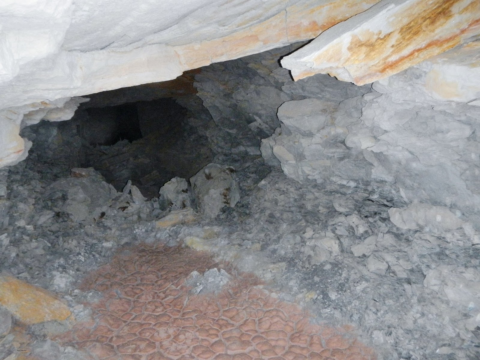
 Around the 10 mile mark, I was photographing the vistas when I noticed a couple of white poles; what could they be? Roy supposed that they might be marking a trail, so, with our eyes, we followed one pole to another. Yes, it was a trail, of sorts; a trail that led to openings in the cliff face and we recognized them as belonging to a mine. At 10.6 miles, there was a small pull in area where we parked, walked the trail and explored what we could. No, we did not go deeply inside...abandoned mines are bad!!! There could be cave-ins, toxic gases, holes in the floor to fall through, people living, or illegally working the mine, inside, or even animals. Fry, Red and White Canyons were heavily mined areas for copper, uranium, vanadium and a slew of other minerals; toxic run-off polluted water sources; the dangers of uranium forced closings of almost all the mines. Historically, the mining era of San Juan County should not be forgotten nor discounted; while many became rich (mainly the owners of the land that was mined, and/or the owners of the mines themselves), many died due to illnesses associated with uranium, and its waste. "From 1949 to 1982, 2.26 million tons of ore containing 11.1 million pounds of uranium oxide were produced from 125 mines." (Source: "Selected Mining Districts of Utah" (page 35) by Carl L. Ege)
Kerry L. Shumway remembers working the mines; "I worked in the Radium King mines as a teenager (mid 70's). Used to take this route to work every week. I worked in the Radium King West Channel circa 1973 and the Yankee Girl circa 1977, and some contract clean-up and prospecting work at the Radium King on a few occasions around that same time. My grandma used to try to get me to figure out a way to get that arch rock (see Fry Canyon - Part One) moved to her rock garden in Blanding."
I did a lot of checking, but this particular area (10.6 mine on cliff ledge - Radium King Road - San Juan County, UT - GPS: 37.577584, -110.184326) was not listed.


Red Canyon

 |
| Creation of a Pothole |

Mile Mark 11 brought us to another abandoned mine up on the green hills, plus part of an old pickup truck basking in the sunlight. (11.0 mine up hill; abandoned pickup - Radium King Road - San Juan County, UT - GPS: 37.576177, -110.189653). We hiked up the hillside, debris littered the area; carefully we checked the flooring in the wooden shack and we could hear a hollow echo below. Going in further would have been asking for trouble, as the planking could very well have given way to a mine tunnel below.
I went to a mine location site (http://www.mindat.org/) and established that two mines were located north and central to the two abandoned mines we had found: Spook Dee and Knot-Knob Hill. Could the tunnels and shafts we had found been extensions to either of these? Unfortunately, even though there were the white poles identifying trails; the area had been stripped clean of any item which would have had the mine names.
Abandoned Vehicle


 |
| Tables of the Sun. |
 |
| Wingate Mesa, Tables of the Sun Panorama. |
Abandoned Mine


Mine Debris


This is my favorite photo; my most favorite traveling companions, adventurers and co-conspirators; my husband, Roy and dog, Jenna.

Wingate Mesa


 |
| Tables of the Sun. |
 Mile mark 12.2 brings us to a pond; due to the leeching of copper and uranium into the ground water, I'd advise not to swim in it, and don't let your pets drink from it. Not too far down the road is a ground level formation that we found to be interesting.
 12.6 miles brings us to the Daneros Mine; established in 2010, this uranium mine produced ore until October 2012. Daneros was developed and placed into active production in 2010 by Utah Energy Corporation (UEC); UEC was acquired by Denison Mines Corp. in 2011, then by Energy Fuels in 2012; ore from the mine was processed at Energy Fuels’ White Mesa Mill. As of December 31, 2013, the Daneros mine still contains approximately 156,600 tons of ore which includes at least 661,000 pounds of U3O8.


...and so ends part three of our two days in Fry Canyon. There is so much more to do there, but not until it gets warmer, and the wet areas dry up. Until then, we will be adventuring around to, well your guess is as good as ours.
Mary Cokenour