Showing posts with label Abajo Mountains. Show all posts

Friday, August 16, 2019

Customer Service People Deserve Respect.

I don't know why, I don't believe I will ever understand why; but why do tourists "test" welcome center representatives.  I've lost count of how many people would ask a question and afterwards say, "I was testing you to see how smart you are?"  Excuse me, how smart I am?  Could a person get anymore insulting?  I often learned that, when someone was about to be this rude to me, they would have a certain demeanor, a certain smug expression on his or her face.  Well I was ready for it, and that's when I would snap on my little "Hello, my name is NOT Google" name tag.  The person would read it, the smug expression would drop, and then a real conversation would take place.

Good!  These representatives, depending on which center you visit, can be highly trained in information about places to see, things to do, where to stay and have a meal.  They are not there to be made fools of due to someone being bored.  They are not walking computers, and certainly not there to be insulted.  They are there to help, and visitors need to learn two special words, "Thank you".

Now there is a center or two where the representatives are there for a paycheck and nothing more.  They don't care about learning the information, being able to read maps, and give out the proper ones. They don't care if you stay in the area or are just passing through.  These types are a blot upon those who do have a passion for being a tourist guide, and for sharing the love of what they do with others.

Anyway, I put together a little San Juan County Basic Information so the need to "test" can be avoided somewhat.  Hint, if you truly need to "test", be ready to leave one hell of a huge donation or tip.  It's the polite thing to do you know.

San Juan County Basic Information

Environments
Forest
Mountain
Desert/High Desert
Open range/Brush land (mainly sage brush)
Canyons


Major Industries
Tourism
Farming
Ranching
Government
Gas/Oil
Mining


Farm Crops
Beans
Alfalfa
Wheat
Sunflowers

Elevations
LaSal – 6900 feet above sea level
Monticello – 7100 feet above sea level
Blanding – 6100 feet above sea level
Bluff – 4300 feet above sea level
Monument Valley – 5200 feet above sea level


The Bluffs of Bluff
Mexican Hat

Monument Valley

Does San Juan County have four seasons? 
 

Yes - spring, summer, fall and winter.

Does San Juan County have weather and what is it like year round?  
Yes, it has heat, rain, snow, hail, wind, thunderstorms, sun, clouds.  You know, like the rest of planet Earth.

We're going to Monument Valley, can we go inside the Indians' homes to see how they live?  
Umm, first off, they are Native Americans.  Second, please give me your names and addresses.  Why?  So I can give it out freely and tell everyone that your home is open to any and every one to visit at anytime.  

Why are there no straight roads, why are they so curvy?
The roadways were created to go around the natural landscape of the area, to avoid destroying its beauty.

....and here is a favorite story that my friends still get a laugh fest out of.  One day a woman came into a center I was working at and said, "I just drove up from Blanding and where are these mountains I was told I would see?"  (only one highway travels north from Blanding, Highway 191)

I walked her to the windows and asked, "You mean those mountains over there?" (pointing at the Abajo Mountains).

She responded with an incredulous tone of voice, "Hey, they weren't there before!"

...and my response?  "Oh, it's Wednesday.  They were sent out for cleaning, and were just put back." (mind you, there had not been any cloud cover to obscure the mountain range, it was a beautiful sunny day)


Abajo Mountains - Sunny Day

Abajo Mountains - Cloudy Day

Please take the time to engage the brain first, before opening the mouth.  Customer service people are not there to be your personal entertainment, and deserve the same respect that you expect for yourselves.  Give as good as you want to get.


Enjoy the journey!

Mary Cokenour


Monday, August 5, 2019

Why Go the Mountain Path?

In this age of  "technology rules, brains drool", so many visitors to San Juan County don't have a clue as to why they are even in the area.  There was a time, an ancient time, when one did research on planning out a vacation.  Library for information, travel agents supplying guides, AAA for mapping out a quest.

Now it's Siri or Alexa...which is discrimination against the male sex...whatever happened to Tom-Tom!?!  Anyway, the majority are so busy asking their cellphones, tablets, IPads to plan out their lives for them; well people have stagnant water for brains now.

One question that always annoys me about visitors is, "Is it worth it to me to go (insert destination)?"
Umm, do I know you?  Do I know your likes, dislikes, passions, bucket list, fears, must-dos?"  No, no I do not.  While I can tell you how much it is worth to me, we  are NOT the same person, so stop asking this rather ridiculous question.  Oh, did I offend you?  Good!  Put the cellphone down, stop asking it what to do, open your eyes and start enjoying the vacation!!!  Go everywhere you can, see all you can see, experience wherever you go as if you're a resident.  On old phrase that used to carry a lot of weight with travelers was, "When in Rome, do as the Romans do."  In other words, live like you live there.

So, most folks I have met are dead set on going to National Parks and Monuments only; it's all they have heard about, only thing of importance within any state they visit.  Wow, why in the world do these people limit themselves so much?  Canyonlands National Park is located in San Juan County, the entrance to the southern end, Needles, is just north of Monticello on State Highway 211.  Many people go the quickest route, State Highway 191, but forego the one paved mountain road through the Abajos.  Many are thankful when told about this alternate, quite scenic route; while others are, "Why would I want to go that way, it's just mountains and a forest?"  This is another example of limiting one's self; there is so much to see along the way, but you won't know till you go.

I'm going to show you, via photographs, why it's worth it to me.  You will have to be brave, take the journey yourself, and then decide how much worth for yourself.

Landscape

7 miles up the mountain road is Monticello Lake.


North Creek's rushing waters due to the spring thaw.


9 miles up, Panorama taken at an informational rest area.

 Shay Mountain in the distance; Storms are normal during July and August.

At 10 miles up the paved road, 2 choices; left is to Foy Lake which has camping, fishing, mountain biking trails and the road to Shay Ridge and Shay Mountain.

Right is Harts Draw Road which will lead directly to State Highway 211.


Indian Creek Valley; SH 211 will take you through this area.

La Sal Mountains and Dry Valley


If you don't mind a bit of detouring, a road can be taken from Monticello Lake which will lead to Spring Creek Road.  Lots of scenic views, but you'll end up coming out onto SH 191; or you can simply turn around, head back to Monticello Lake and then continue the journey along the paved mountain road.  Like I keep writing, don't limit yourselves!

Abajo Mountains seen from Spring Creek Road

Spring Creek is full during spring thaw.

Abajo Mountains and Latigo Wind Farm
There is an abundance of natural wonders to be seen: plants, trees, wildlife; I love photographing it all.  Ranchers often have cattle grazing up in the forest too.

Wildlife

Wild Turkeys
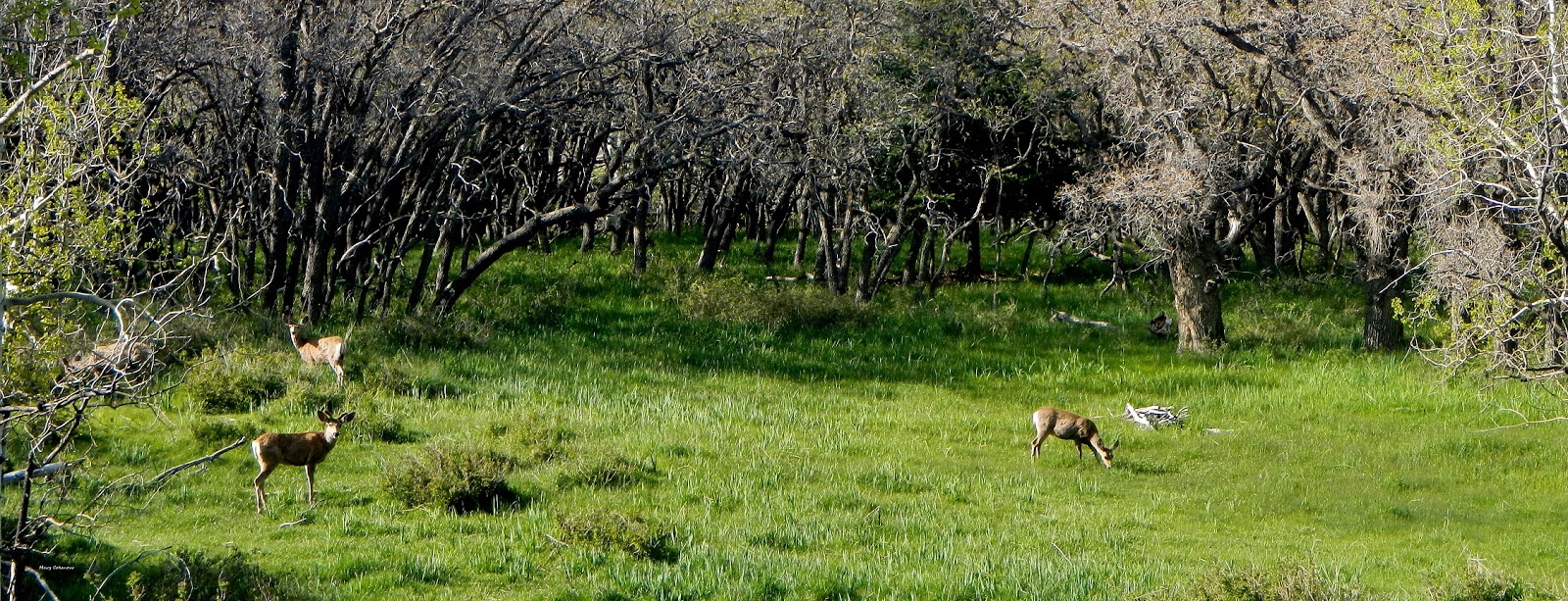
Mule Deer


Photoshopped to look like a walking billboard; No cattle were shaved.


Roosters are not allowed in Monticello City limits.  Someone dumped this little guy.  We
couldn't catch him and chances are he ended up a coyote's dinner.

Plant Life

Arrowleaf Balsamroot
Blooming Yucca


Colorado Aspen
Common Globemallow


Golden Pea
Lupine


Due to the drought the past two years, this plant remained in hibernation.  Winter 2018 - Spring 2019 were very wet seasons, so Milk Vetch could be found in abundance.


Stinking Milk Vetch

Utah State Flower - Sego Lily


There you go, a little landscape and nature tour while traveling up into the Abajo Mountains and then down Harts Draw Road to State Highway 211.  Very worthwhile every moment to me, but for you, well only you  can make that decision.

Life is an adventure, or nothing.  Helen Keller

Mary Cokenour

Saturday, August 3, 2019

Harts Draw Road Travel Guide.


Harts Draw Road Loop


The Harts Draw Road loop begins at the intersection of Hwy 191 and West 200 South Street in Monticello, travels west up into the Abajo Mountains, and is the only paved road through the mountains  . As the road climbs, plant life includes forests of Gambel oak, Ponderosa pine, Douglas fir, aspen, spruce and wildflowers of many varieties. Wildlife sightings are usually of mule deer, wild turkeys, squirrels and grazing cattle.  Stunning views of the surrounding Canyonlands are available at nearly every turn.

·         Location is .3 miles south of Monticello's traffic light (Main and Center Streets), along Hwy 191; turn right onto West 200 South & follow curve onto Abajo Drive (total of 7/10s of a mile to start of paved road up the mountain).  County Rd. 101/North Creek Rd. is 10 miles upward with a turn downward onto Harts Draw Rd., leading 10 miles to Hwy 211.  


Created in 2014 by me to help navigate the City of Monticello, when
trying to find the street to the mountain road.  A few focus points are noted, like the local grocery,
library and park.
·         Loyd’s Lake is 1 mile west up CR 101, one (1) mile south on CR 102; 2.5 mile hiking trail around lake, picnic/barbecue areas, vault toilets, no camping allowed.


·         Monticello Lake is 7 miles west up CR 101, offers vault toilets, dispersed camping.

·         Foy Lake is off a short trail west of the merge of CR 101 & Harts Draw Rd., vault toilets, dispersed camping.

·         Two (2) National Forest Campgrounds: Dalton Springs at 4.5 miles & Buckboard at 5.5 miles up CR 101.

·         Pets – must be leashed at all times, owners are expected to pick up after their pet(s).

·         Website: https://www.fs.usda.gov/  (type manti la-sal in Search box) US Forest Service Ranger District Office is located at 432 East Center Street (Hwy 491), Monticello

·         Phone: (435) 587-2041

This is a beautifully scenic and serene drive through the Abajo Mountains.

Mary Cokenour

Sunday, July 29, 2018

The Much Awaited Shay Ridge/Shay Mountain Trails Adventure.

Back on April 23, 2018, I gave you a teaser of this trail and several of my fans were wondering, "Why am I not writing!?!"  Real life has a habit of getting in the way of what we enjoy sometimes.  Being employed, paying those bills, medical emergencies, losing beloved pets, fighting to keep a good name when others are trying to defile it; yep, life sucks sometimes and just gets in the way.

By the way, I am dedicating this write up to a lovely family, from Michigan, that stopped in, July 25, 2018, to see me at the Canyon Country Discovery Center.  They had been using this travel blog for adventuring through San Juan County, and made sure their last stop would be to meet me, and experience the inter-active exhibit hall and climbing wall at the Center.  Thank you so much for enjoying my blog, and making my day!!!

There were others who have come in to meet me, and I need to dedicate some of my stories to them as well.  Don't worry, I have not forgotten any of you!

Today, a most welcome pajama day Sunday, I finally sat down at my computer to whittle down 128 photographs of this trip into a manageable 39.  After about 2 hours of enlarging, squinting, adjusting; the eyes were a bit on the wonky side.  A homemade lunch and watching episodes of "Relic Hunter" was a very welcome cure for the "wonkies".

Shay Ridge, Shay Mountain, Shay Canyon, who was this Shay that had three areas named after himself.  The old name standby Utah's Canyon Country Place Names, Volume 2 by Steve Allen gives us this answer on page 685, "R. McDonald in 1885: "Col. Shay, the old Indian guide has a contract from Carlisle Bros. (cattle company) for building corrals, cabins and pasture fences; also digging ...ditches and breaking land and sowing alfalfa."  The name, Shay, became a map place name by 1891.


As I explained before, the Shay Ridge Trail (FR 104) is located at Foy Lake, it's the trail to the right of the vault toilets.  A maintained (graded) dirt trail that is prone to landslides of mud when it rains heavily, so during monsoon season (usually the entire month of July) beware of the rains that come suddenly and without warning.  The landscape is beautiful, then again, when isn't the landscape stunning in the Abajo Mountains and Manti-LaSal National Forest!?!


At mile mark 3.4, a hiking/horseback riding trail is off to the left, past a large boulder; walking down the trail will reveal many more large boulders with striking shapes, native plants growing out from cracks, and one with a layer of stones as its outer covering.  There was evidence of camping in the area (stone fire rings) as well.


This tree points the way down the non-motorized trail.


The entire boulder was covered with this.


Mile 4.4, right side and looking up onto the ridge was an unusual site, a boulder was being held aloft by the roots of a fallen tree.  When I show you the wondrous Ponderosa Pines that are along this trail, you'll understand why the roots have to be so strong, they can lift up a boulder.


At mile mark 4.7 is another fallen tree whose roots look to form a sort of arch, or use the imagination and maybe you'll think it looks like an egret, heron or crane with uplifted wings.


Let's get to those wondrous Ponderosa Pine trees, they are huge, with bark resembling some sort of patchwork quilt.  Standing next to one, touching the bark; that's as close to hugging a tree as I'll ever get, thank you very much.  One of the photos has my hubby's Toyota FJ for size comparison; unfortunately, financial hard times caused him to lose that vehicle and we just couldn't get the back due monies together fast enough before it was sold off at auction.  At least we have some really great memories of places it took us that a car could never go. 


As close to being a tree hugger as I'll ever be.


Ponderosa Pine Bark

There was a nest inside this hollowed out tree.
Mile mark 5.2 is a split in the road and trail signs to tell you what's ahead on each.  Shay Mountain we did on the way back, after reading the 4 wheel drive section of the Shay Ridge road.


Bearing to the left hand trail and onward to the Shay Ridge trailhead; mile mark 5.7 though was too pretty a spot to pass up.  There are many downed trees there and it must be a popular spot for wood gathering, evidenced by the limbs that were obviously chain sawed off. 


Good thing I was watching where I walked, or I might have stepped on, and killed, a most adorable creature...a Great Horned toad aka Horny Toad, and this one was a baby!  Ok, you just said to yourself, "Adorable?  A horned toad?"  Yes, to me they are, then again, I like snakes and lizards too.


At mile mark 6.2, that is where the 4 wheel drive trail ends, and the Shay Ridge Trailhead begins; the only access is an opening in a  wooden fence large enough for an ATV, horse or hiker to go through.  I walked up the trail only about 100 feet to get a feel for it.  We still had to check out the trail to Shay Mountain and knowing a storm was coming in that day meant time could not be wasted.


Back to mile mark 5.2 and the right hand trail to Shay Mountain, 4-10ths of a mile in was trail #437 and only fit for ATVs or hiking.  8-10ths of a mile in was the actual beginning of the ATV trailhead to Shay Mountain itself..  Back in the 1930s, the leader of the Home of Truth cult, Marie Ogden would drive frequently drive, in her rather large, expensive car, to the mountain, climb to the summit and receive revelations from God.  Looking at the photo of the trail, like myself, you're wondering how did she get her car even a quarter of a mile up it.  Back then, the trails were wider and flatter, since many ranchers and locals needed to drive their own vehicles, and not all had pickup trucks.  Time, erosion from wind, rain, and the wider wheels of ATVs and larger sized 4 wheel drive vehicles, made a road into a two-track, narrow, deeply rutted trail.  Wandering around that area, there was some decent hiking and more large boulders to explore, but it was time to head home and beat the dark clouds that were coming in from the west.


There you have it, our adventure to Shay Ridge and Shay Mountain, well as far as we could get without ATVs.  Why didn't we hike it and camp out?  Yeah, I don't camp...no, just no.

Hope you enjoyed the story and remember, need a great rest stop, want to play with inter-active exhibits and maybe climb a rock wall; visit me at Canyon Country Discovery Center.  By the way, there is also information (free guides, brochures, maps) available on Utah, Arizona, Colorado, New Mexico and Wyoming for adventurous travelers.

Mary Cokenour